Mapping Compassion: Why Tracking Cat Cruelty Matters — and How Our Community Can Help
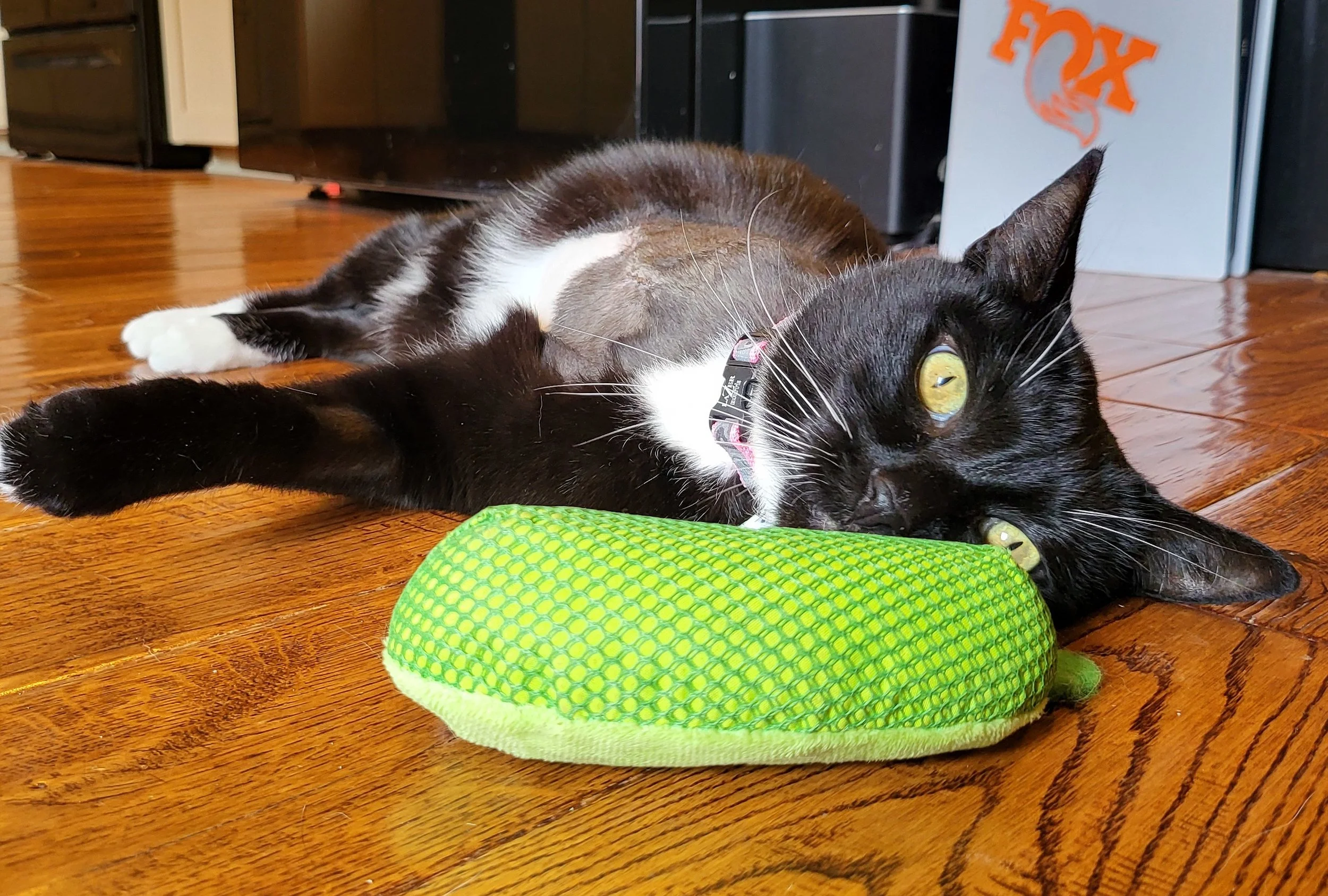
When Jade was hurt, our world shifted. The shock, the fear, and then the long road toward healing opened our eyes to something deeper: the need for shared awareness. No family should ever feel alone in facing something like this, and no cat should be harmed without the community knowing, caring, and responding together.
That belief inspired one of our newest tools — an interactive cruelty-tracking map now embedded on The Jade Project homepage. It’s simple to use, gentle in appearance, and powerful in purpose. And it’s only just beginning.
What the Map Looks Like — and How It Works
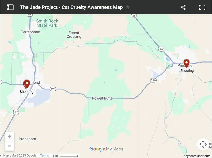
When visitors scroll down our homepage, they’ll find a familiar sight: a clean, easy-to-navigate Google Map, centered on Central Oregon. From afar, the map shows small red markers representing each verified cruelty incident. With just three entries so far, the view feels quiet — but each point carries a story that matters.
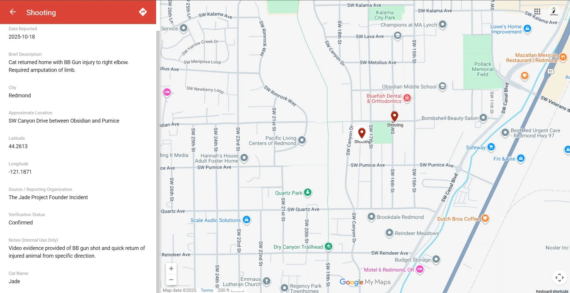
Click on any marker, and a panel opens on the left side of the map. There, users can read a brief, factual summary: the type of incident, the date it was reported, the approximate location, how the information was verified, and the cat’s name if the family wishes to share it. It’s designed to be clear, compassionate, and minimally intrusive — offering just enough detail to inform and protect without overwhelming.
The map will grow as we work with local veterinarians, animal control teams, and community members to gather additional verifiable data. Soon, it will offer an even clearer picture of the trends that shape our community’s safety.
Why Tracking Matters — For Cats, and For Us
Cat cruelty is not just a personal tragedy; it’s a community issue. And like many community issues, awareness is our first and strongest tool.
By tracking locations and dates of confirmed cruelty incidents, we can begin to understand:
Awareness Hotspots: Where families may want to take extra precautions with outdoor cats.
Patterns Over Time: Whether incidents cluster in certain areas or repeat in ways worth monitoring.
Opportunities for Outreach: Where education, resources, or conversations may help prevent future harm.
Stronger Partnerships: Giving veterinarians, local authorities, and animal advocates better information to guide their efforts.
Each data point is a step toward a safer world — not just for cats, but for the people who love them.
How We Verify Each Entry
Because accuracy is vital, nothing is added to the map until it has been confirmed through:
veterinary documentation
animal control or law enforcement records
or community reports supported by verifiable evidence
Our goal is clarity, not fear. Knowledge, not rumor. Prevention, not blame.
This careful approach ensures the map remains a trusted, responsible resource as it grows.
The Long-Term Possibilities
This map is young, but its future is bright. With time, it can become:
a regional cruelty-awareness report updated in real time
a guide for targeted outreach and education
a tool that strengthens collaboration between families, veterinarians, and animal-protection teams
a living reminder that change is possible when people care enough to get involved
Every dot on the map is a chance to build something better.
How You Can Help Today
Your voice matters more than you may know.
Share information.
If you know of a confirmed or suspected cruelty incident — recent or past — please reach out. Even if you’re unsure whether it “counts,” we can help verify and determine next steps.Share this post and the map itself.
Awareness grows person by person. A simple share might help another family keep their beloved cat safe — or encourage someone to speak up.
Together, we can turn data into protection, awareness into prevention, and pain into purpose.